Climate change could bring both bigger rains and longer droughts to California. What do the bigger rains mean for the state’s water management? We talked to Mike Dettinger—a research hydrologist with the US Geological Survey and a PPIC Water Policy Center research partner—about the weather phenomenon known as “atmospheric rivers.”
PPIC: What are atmospheric rivers?
Mike Dettinger: They are long pathways that transport water across the atmosphere. Typically they’re at least 1,200 miles long; the biggest can be five times that. They tend to evolve as they cross the Pacific. Those that manage to reach the West Coast meet a more-or-less abrupt end when they hit the mountains, dumping rain and snow in the process. These storms carry a lot of water—a big one can move up to 20 times the amount of water that comes down the Mississippi River. They can provide a third to half of our annual precipitation in just a few storms.
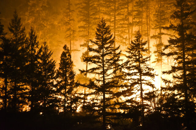
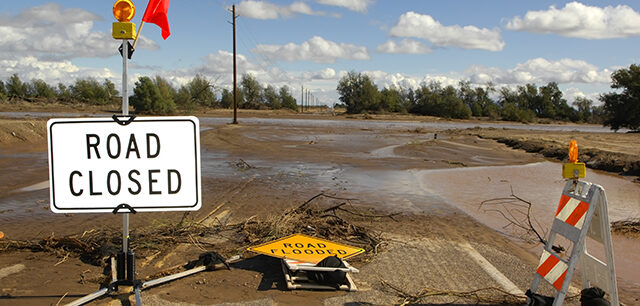
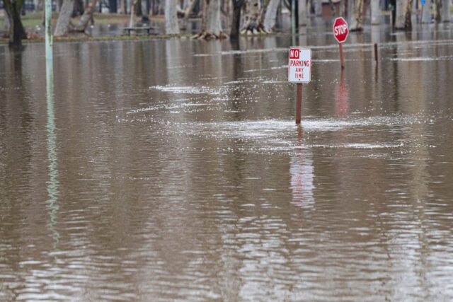
Because they’re usually warmer than other types of storms, larger areas of our river basins get rain rather than snow, which increases flood risk. In the past 60 years nearly all of our largest storms and most damaging floods were caused by atmospheric rivers. The largest ones have brought 12–16 inches of rain in a few days. On the plus side, they also bring ecologically beneficial flooding for wetlands and are a major factor in ending our droughts.
 PPIC: Can we predict when these storms are coming?
MD: We’ve got about a decade of understanding atmospheric rivers in practical and useful ways. The California Department of Water Resources and others have responded by investing in an enhanced water monitoring network. These efforts and a lot of basic research have revolutionized forecasting of California’s largest storms, which is critical for reducing flood risks and managing water supply. A decade ago the weather service wouldn’t forecast storms beyond three days. Now we routinely receive forecasts of major storms a week or more in advance. We’re working to improve forecasting even more, especially in terms of the details of where and how intensely the storms will land. The hope is that better forecasting can allow dam operators to keep more water in reservoirs at the end of the rainy season while better managing flood risks.
PPIC: How might climate change affect these storms?
MD: As the world warms, the atmosphere will be able to hold more water. Climate models agree that we’ll see more atmospheric rivers—likely a doubling by the end of 21st century. How much water they’ll bring is less clear—some models show a 10–15% increase. But most of the increased rainfall will come from a larger number of these storms than from how much water they hold.
About half of climate projections show California getting wetter, while half show it getting dryer. If you dig a little bit, nearly all projections show an increase in the number of atmospheric rivers, and virtually all show a decline in other types of storms. That decline will bring more dry days, punctuated by these major storms. So if we indeed do get the wetter future, it’s because of more potentially dangerous atmospheric rivers. It’s a Faustian bargain.
We’ve spent a century building up a flood control system that tries to take the peaks off the worst floods. This has put our ecosystems at a disadvantage, as they evolved with regular floods. I think we’ll find it harder to control floodwaters as climate change builds, and that might tend to bring us back to something more like what California’s natural systems evolved under—allowing bigger areas to absorb floodwaters in winter. It will be interesting to see how we achieve balance and who will be the winners and losers. We have a lot to learn.