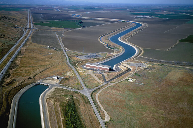
- The water grid is a statewide network of storage and conveyance facilities.
Most of the water supplies for California’s cities and farms depend on the capture and storage of winter rain and snow in surface reservoirs and aquifers. Storage alone is not enough, however. California also relies on thousands of miles of canals and aqueducts—as well as rivers—to move water to where it is needed. This network of above- and below-ground storage and conveyance systems—operated by diverse entities—serves as a “water grid.” - The grid provides multiple services, which are sometimes in conflict.
The grid not only meets needs for water supply, it is also operated to safeguard downstream residents from harmful floods, protect fish and wildlife habitat, and support recreation. Many of the grid’s dams also generate hydropower, supplying about 15% of the state’s electricity on average. However, the many demands on the grid are sometimes in conflict. For example, flood protection works best when reservoirs are empty and can capture water from winter and spring storms. But water supply managers seek to fill reservoirs during these same times to meet summer demands. And the needs of hydropower, recreation, and the environment often conflict with both supply and flood control. The challenge for the grid’s managers is how to balance these competing objectives. - Important elements of the system are in poor condition.
The state’s water infrastructure is aging. Two-thirds of California’s dams are at least 50 years old, and more than 90 need major upgrades to better handle large floods or withstand earthquakes. The aqueducts that convey water across the state are also facing problems. Three of the most important in the Central Valley—the California Aqueduct, the Delta-Mendota Canal, and the Friant-Kern Canal—have significant reductions in their capacity caused by land subsidence from excess groundwater pumping. Overuse of groundwater in many parts of the state has dried up drinking water and irrigation wells, harmed wetlands, and increased the energy costs associated with pumping groundwater. Strategic investments are needed to help California store and convey water more effectively and take better advantage of opportunities to trade it—an important way to reduce the social, economic, and environmental costs of water reductions. - Management of the grid is fragmented.
The grid’s dams, canals, and aqueducts are owned and operated by a wide array of federal, state, regional, and local water agencies. This makes water accounting, management, and governance of the grid very complex. And although surface water and groundwater are physically connected, they are not explicitly linked in California water management practices. Implementing the Sustainable Groundwater Management Act should strengthen the surface water–groundwater connection. - The grid is ill-prepared to handle climate change.
Five key climate pressures—warming temperatures, shrinking snowpack, shorter and more intense wet seasons, more frequent extreme wet and dry years, and rising seas—will make it harder to store water for droughts, manage floods, and protect freshwater ecosystems. Climate change is already affecting management of the grid. Warmer, more intense droughts—such as the one California experienced from 2012-16—increase pressures to draw down groundwater reserves and reservoirs. Warmer, more intense storms add stress to surface reservoirs. California’s water grid is not prepared to handle these mounting pressures. Yet the grid is also the state’s most valuable asset for adapting to the changes in store. Adapting to a more volatile climate will require more operational flexibility to enable storage and conveyance facilities to work together as an integrated water supply and flood management system. Increasing the use of natural infrastructure such as restored floodplains can also help.
The water grid includes both surface and groundwater systems
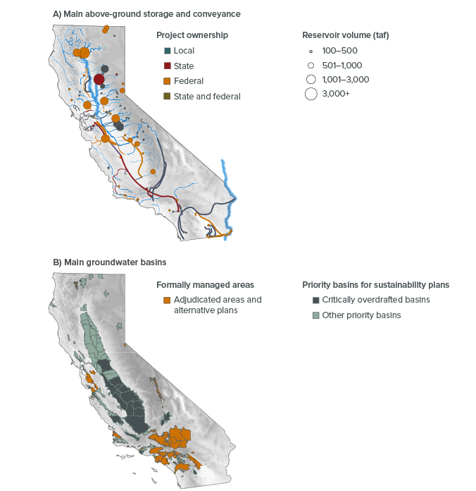
SOURCE: Developed by the PPIC Water Policy Center using information from the California Department of Water Resources.
NOTES: “Taf” is thousands of acre-feet. The top map shows 62 surface reservoirs with storage capacity greater than 100 taf, scaled to size. Their combined capacity is 36.5 million acre-feet (maf). The lines show rivers in blue and built conveyance infrastructure facilities (canals, aqueducts) colored by ownership. Not shown are more than 1,400 smaller reservoirs (with a total capacity of less than 7 maf). The bottom map shows 85 priority basins subject to the Sustainable Groundwater Management Act (SGMA), and 43 areas where groundwater is already formally managed through adjudication (a court agreement on how much groundwater can be extracted—34 basins) or other special management arrangements (9 basins) as of August 2019.
Topics
Drought Floods Paying for Water Water Supply Water, Land & Air