
FloodedSwingSet
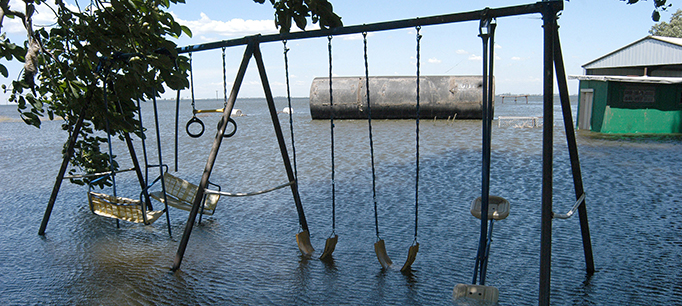
Ground view showing damage to residential structures and surrounding areas in Jones Tract following the levee break on June 3, 2004. Shot – June 7, 2004 by Paul Hames/DWR Photography. On a beautiful, sunny morning when the levee on the southwest side of Upper Jones Tract breached, within 48 hours both Upper and Lower Jones tracts were flooded, forming a new 12,000-acre lake in the central-south delta, The 300-foot breach was 10 stream miles northeast of the State Water Project’s Clifton Court Forebay gates and 11 stream miles northeast of the federal Central Valley Project‘s Delta-Mendota Canal intake. While the exact cause of the breach is still not known, theories range from a burrowing rodent to the eventual structural collapse of the antiquated … and un-maintained … peat-filled levee. * FOR EDITORIAL USE ONLY *