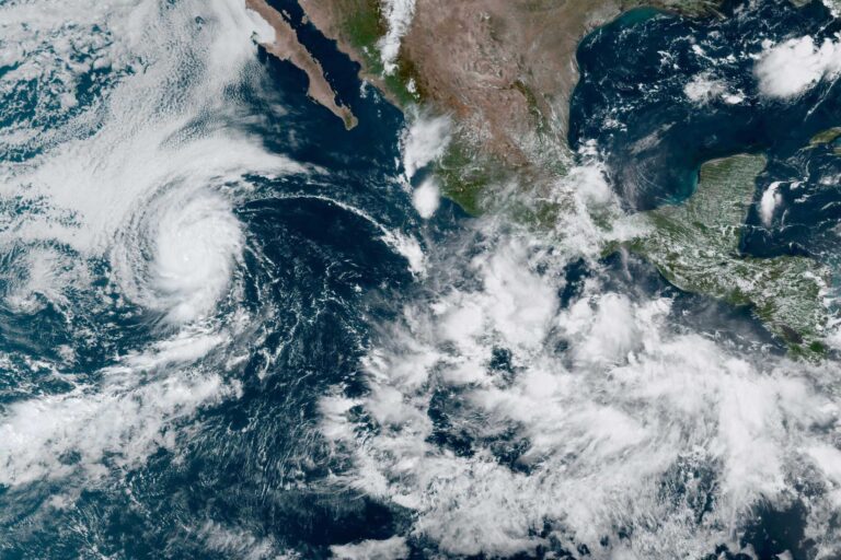

Tropical Storm Hilary hit coastal Southern California and the desert interior on Sunday, after making a destructive run over Baja California. It will take weeks to know the full extent of the damage from this unusual storm in a remarkable year of unusual weather. But some key takeaways have emerged.
Pacific tropical cyclones like Hilary rarely make landfall in California for a good reason. Most originate well to the south, relying on warm ocean water for their energy and moisture. If steered to the north and into California by circulation patterns, they run out of “gas” quickly as colder ocean temperatures sap their energy. That is what happened to Hilary, although it retained a lot of its moisture as it moved rapidly through California and later the Intermountain West, leading to prodigious amounts of rain.
Hilary was not, by any means, an unprecedented storm. There have been two very large tropical storms that made landfall in Southern California—one in 1858 in San Diego and another in 1939 near Long Beach. Both caused widespread destruction and loss of life. Numerous other storms that originated as tropical cyclones have caused summer rainfall events in California. And California’s deserts and mountains are regularly affected by tropical moisture that moves up from the south, forming our summer “monsoon” season.
But Hilary was notable for a couple of reasons. First, forecasters did a good job of predicting the path and intensity of the storm days in advance of its arrival. Rainfall amounts and timing were close to predictions, with record-breaking daily amounts in many locations—and in some places the highest seasonal amounts ever recorded.
Stirring controversy are erroneous claims in the press and online that the intensity of the storm—and thus the risk of loss of life and property—was over-hyped. This absolutely was a high-risk storm. But subtle shifts in its path away from population centers, along with some luck—including spreading the precipitation out over time rather than occurring all at once—reduced the damages.
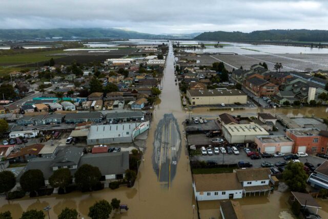
And it remains remarkable that no lives were lost. Why did this happen? There was plenty of life-threatening flooding throughout Southern California and the desert regions. But strong messaging before the storm hit—leading to high public awareness—along with emergency preparation and response prevented loss of life. It also helped that most of the flooding occurred in areas with low population density. Just because people did not die does not mean the threat was overstated.
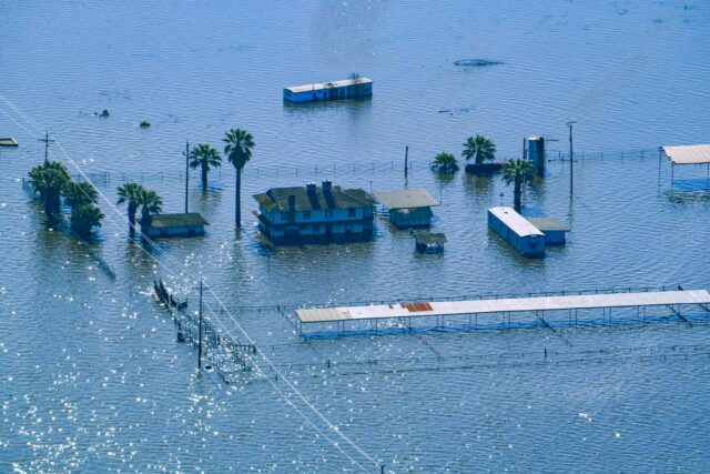
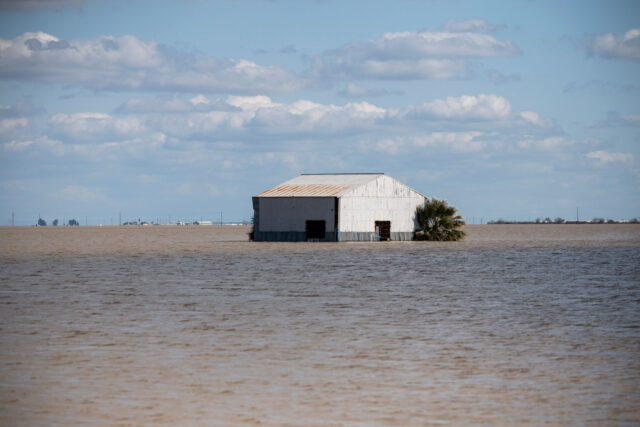
Second, most flooding associated with Hilary was vastly different from our winter floods. During the winter and spring, damaging flooding is usually caused by days of intense rain that fills reservoirs and overwhelms downstream flood control infrastructure, such as levees. It is the large amounts of rain falling on saturated landscapes that produce the runoff for these floods. Most of our flood control infrastructure is built around these winter floods.
In contrast, the high-intensity, short-lived rainfall of Hilary produced flash floods and debris flow floods. Flash floods are floods that rise and fall rapidly, usually over hours. Debris flows often start as flash floods, but turn into thick, fast-moving slurries after picking up vast quantities of sediment and vegetation. These flows are so dense and viscous that they can move large boulders many miles (which is why you see boulders so far away from canyons in many desert landscapes).
Many parts of Southern California and the desert regions are at high risk from flash floods and debris flows, as residents of Palm Springs and other desert towns experienced this week. But unlike winter floods, this is less a regional threat and a more local threat. The best strategy for managing flash flood and debris flow risk remains the simplest strategy: good land use planning that steers development away from high-risk areas.
The jury is out on whether Hilary’s trajectory and intensity are a signature of climate change. There is no doubt that conditions in the Pacific—the source of tropical storms—are changing. And some modeling suggests that summer storms may become more intense with increased warming. But to date, there is no consensus on whether Hilary-like storms are going to become more common.
Water year 2023 (October 1, 2022 through September 30, 2023) remains on track to be one of the weirdest years in memory. From October through late December we had a continuation of a brutal multi-year drought. That gave way to a winter’s worth of precipitation in three weeks, from late December to mid–January, with lots of floods. Then in late winter/early spring we had even more floods, built a genuinely epic snowpack, and saw the return of ancestral Lake Tulare. Add to that tropical storm Hilary, and long-time weather watchers may conclude that the California weather gods must be crazy.