


In the midst of the COVID-19 crisis, work continues on managing groundwater for long-term sustainability, as required by California’s landmark Sustainable Groundwater Management Act (SGMA). In January, water users in 21 critically overdrafted basins delivered their groundwater sustainability plans to the state Department of Water Resources. In this series, we examine the 36 plans submitted for 11 critically overdrafted basins in the San Joaquin Valley—California’s largest farming region, where excess pumping is a major challenge.
Why does surface water access matter for groundwater sustainability?
Although the San Joaquin Valley has the largest groundwater deficit in the state, water resources vary considerably within the region. A few areas receive abundant surface water. Most others supplement with groundwater. Still others depend entirely on groundwater. In many areas, groundwater is being used at unsustainable rates and pumping will need to be cut to bring basins into balance.
Irrigated agriculture is a major industry in the valley, and the largest water user. Our in-depth study of water solutions for the region found that ending overdraft will entail fallowing at least 500,000 acres of farmland. Access to surface water will be a key factor in determining which croplands stay in production, and which lands are retired.
How does surface water availability vary across valley farmland?
Last year we identified the location of groundwater-only croplands. Our newly compiled dataset allows a much richer view of surface water availability across the region. The maps below show surface water per acre of irrigated agriculture, using average water deliveries from 2001‒15 and cropland mapping from 2016. Surface water averages 1.8 acre-feet per acre valleywide, but availability varies widely both within and across basins. As a rough guide, lands with less than 3 acre-feet per acre of surface water generally need to supplement with groundwater. The less surface water there is, the more groundwater is needed.

How does the growth in perennial crops affect approaches to sustainability?
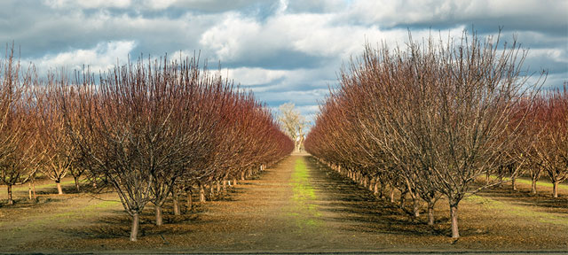
Since the early 1980s, the valley has seen a sustained shift from annual crops to perennial fruit and (especially) nut orchards. Perennial crops now occupy nearly 60% of irrigated lands. More than 20% of perennial acreage is on groundwater-only lands.
The expansion of orchards has benefitted the regional economy, enabling valley agriculture to generate more GDP and jobs than would have occurred if farmers had not made this shift. But perennials are less flexible, because they need to be watered every year to maintain the investment. With groundwater cuts looming, areas with little or no surface water are on the front line of the effort to bring basins into balance. Inflexible approaches to managing this transition could result in unnecessarily large, undesirable reductions in high-value crop acreage, regional employment, and GDP.
What solutions are different areas pursuing?
Bringing basins into balance will require expanding water supplies or reducing water demands. The new groundwater sustainability plans generally emphasize new supplies—with groundwater recharge projects and a variety of efforts to expand or extend surface water deliveries. Fewer plans focus on demand, and those that do give few details on their approach. By our estimates, the plans are too optimistic about the availability of new supplies, and more demand management efforts will be needed.
Basins with less surface water for irrigation are more likely to include demand management as part of their portfolio. For instance, water-short Madera County outlines a range of efforts to augment recharge and to purchase surface water from more water-rich areas. But it also anticipates the need to gradually reduce groundwater pumping by nearly 120,000 acre-feet in the Madera and Chowchilla basins.
Only a few areas—mainly some districts in Kern—propose incentives for flexible demand management to reduce groundwater use. This includes pumping fees, voluntary land-purchase programs, and groundwater trading that enables farmers to reduce use on the least productive lands and keep the most valuable lands in production.
Incentives that encourage farmers to trade groundwater locally—and to trade surface water both within and across basins—can make a big difference to the valley economy. We estimate that trading can reduce the regional costs of ending overdraft by two-thirds.
What’s next?
The valley’s variable water conditions call for managing groundwater sustainability at a regional scale. This scale is appropriate for considering many recharge investments, such as expanding regional conveyance to help get unclaimed floodwaters to suitable recharge areas. It is also necessary to help assess the land use implications of valley-wide surface water trading, which has the potential to keep the most valuable croplands in production while putting fallowed lands into new productive uses. Scaling up this work will require collaboration across a broad sector of valley stakeholders—together with their state and federal partners—in much wider and more comprehensive ways than ever before.
Note: The underlying data and additional notes on surface water availability in the valley can be found in Data Set: PPIC San Joaquin Valley Surface Water Availability. The data on supply and demand options identified in the groundwater sustainability plans is located in Data Set: PPIC San Joaquin Valley GSP Supply and Demand Projects.
Topics
agriculture groundwater groundwater sustainability groundwater sustainability plans San Joaquin Valley SGMA Water Supply Water, Land & AirLearn More
Got Surface Water? Groundwater-Only Lands in the San Joaquin Valley
New Opportunities for Trading Surface Water in the Sacramento Valley under SGMA