This is part of a series on issues facing California’s rivers.
Water managers across the state face new and more extreme challenges as the climate warms—from balancing the sometimes conflicting needs of urban, agricultural, and environmental water users to reducing risks from fires, floods, and droughts. We talked to Grant Davis, general manager of the Sonoma County Water Agency, about how his agency is approaching these challenges comprehensively, at the scale of the entire watershed.
PPIC: In your experience, what does it mean to manage at the watershed level?
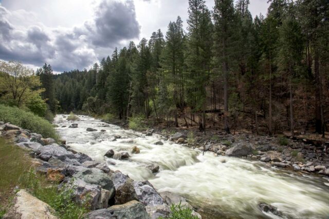
Grant Davis: At its core, managing the Russian River watershed requires careful consideration of different land uses, stakeholders, water demands, environmental regulations, and ecosystem needs. We have to balance the competing needs of our 600,000 customers, a number of endangered species, recreational users, and a thriving farm community. In practice, we’ve changed our management considerably over the years. For example, we now intentionally release water from our two major reservoirs to improve estuary and fisheries management, while still meeting water supply needs.
In 2008, we began implementing what is known as a “biological opinion” designed to protect three endangered species—coho, Chinook and steelhead. An important element is restoring habitat on Dry Creek, a major tributary below our major drinking water reservoir. The idea is to slow water released from the reservoir to provide refuge for the fish. In the short run, it will likely make water deliveries harder, but it’s key to operating our system sustainably long term. When complete, we’ll have 6 miles of restored habitat out of a 14-mile stretch. It’s a multi-million-dollar effort—and a major undertaking in cooperation. Our agency has worked very closely with the regulating agencies and private landowners, who granted easements that enabled this restoration to occur.
PPIC: How do you use data sources to help you manage this watershed?
GD: We’re establishing information networks that bring multiple benefits. For example, we’re collaborating with the US Geological Survey on an integrated rainfall and stream gage network, which can help us evaluate whether storms might cause flash floods after fires. The rainfall data also helps with ecosystem management. In a changing climate, rainfall data is the primary input for understanding our watershed.
Since the Tubbs fire, we’ve begun working with more parties to leverage our respective data needs. For example, working with emergency responders, we’ve established a network of fire cameras that inform a text alert system. And working with PG&E, we’re looking at installing equipment to forecast atmospheric rivers and fire weather at the same weather stations.
It’s also critical that we use science to better understand atmospheric rivers, which will in turn allow us to better manage reservoirs as the climate warms. These large storms contribute to most flooding in California, and up to 95% of floods in our watershed. And the lack of atmospheric rivers leads to drought. We’re now working with the US Army Corps of Engineers, NOAA (the National Oceanic and Atmospheric Administration), the Scripps Institute of Oceanography, the Department of Water Resources, and other colleagues to study this phenomenon. Together, we’re developing a joint project that uses improved forecasting of atmospheric rivers to better manage water releases from reservoirs. We’ve built a coalition with other water agencies—including those in Orange County, Turlock, and Yuba—that are interested in exploring these same issues in their rivers. Data from the project will help us improve how we manage water supply, floods, and the environment.
PPIC: Talk about how the interaction between surface water and groundwater has affected Russian River water management.
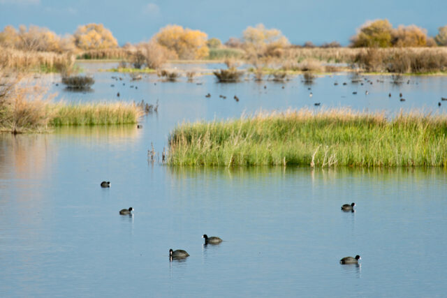
GD: Our watershed is ground zero for efforts to understand the links between groundwater and surface water, and to better manage both together. In 2014, Mark West Creek was selected as one of five priority creeks as part of the California Water Action Plan. The creek goes through a depleted groundwater basin, which has affected its flows. The Department of Fish and Wildlife is now developing recommended flow levels to protect and restore the creek’s critical habitat. The project will also quantify human needs within the watershed.
In places like Mark West Creek, groundwater recharge can play a critical role in addressing the “timing divide” for maintaining freshwater fisheries—because the question is not always whether water is available, but when it’s available. A pilot project in the town of Sonoma will use Russian River surface water in wet winters to recharge the aquifer. We can then pump it when it’s needed in dry summer months for critical uses.
Thanks to Jay Jasperse and Carlos Diaz, both of the Sonoma County Water Agency, for their contributions to this article.