Table of Contents
- Key Takeaways
- Introduction
- California’s Headwaters Are Critical for the State’s Water Supply
- A Major Effort to Reduce Wildfire Hazard Is Underway
- Treatments Differ in How They Reduce Wildfire Hazard
- Where Treatment Is Occurring across the State
- Policy Recommendations
- Conclusion
- Notes and References
- Authors and Acknowledgments
- PPIC Board of Directors
- Water Policy Center Advisory Council
- Copyright
Key Takeaways
- California has dramatically shifted how it manages its headwaters. After more than a century of fire suppression, the state is now engaged in an unprecedented multi-agency effort to reduce the risk of severe wildfire on one million acres of forest each year. Better headwater management will both protect the state’s water supply and help keep residents safe. →
- The state is over halfway to meeting its annual million-acre goal. In the first four years, the task force coordinated and tracked efforts to reduce wildfire hazard on an average of 591,000 acres treated each year. Our research shows that the highest-priority areas received the bulk of the management, indicating that efforts are targeting the right places. →
- These efforts are helping—but their effectiveness varies. While the state and its partners use a number of management techniques, the quality of these treatments and the duration of their impacts vary widely. Focusing on higher-quality treatments with longer-lasting effects in fewer areas may yield more lasting benefits than carrying out one-off activities across a broader landscape. →
- California’s efforts are well targeted but unevenly distributed. Compared to the Sierra–Cascade Mountains, other headwater regions receive disproportionately less treatment. The state also has patchy data on the efforts of private landowners, who own around 40 percent of the lands in need of management. →
Introduction
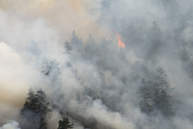
Headwaters are the landscapes where California’s streams and rivers begin. This terrain stores precipitation in snowpack, meadows, and soils, which filter and gradually release water through the spring and early summer. California’s headwaters are vital to the state’s water supplies, providing more than two-thirds of the water used by people each year. However, decades of land-use change and fire suppression have degraded these landscapes and allowed vegetation to build up, drying out mountain meadows and increasing the risk of high-severity wildfires. This has major implications for the state’s water supply. When headwater forests burn in severe wildfires, those fires disrupt the processes that regulate water supply—reducing snowpack, increasing sediment in streams and rivers, and degrading water quality in downstream reservoirs.
Severe wildfires also threaten the over two million homes in California’s headwater regions, which range from Southern California shrublands to mountain communities in the Sierra–Cascades. Many of these homes are located in communities that are increasingly exposed to severe wildfire (Cal Fire Fire and Resource Assessment Program 2018). Long-term changes over the past 150 years—including sustained population growth, the rise and decline of the timber industry, and expanding development in areas where urban and wildland areas meet—have added to these risks. Today, severe wildfires threaten California’s communities both directly, through the destruction of homes, as well as indirectly, through smoke exposure and disruptions to water supplies.
To address these growing threats to landscapes and communities, California and the federal government redoubled efforts in the early 2020s to reduce wildfire hazard by treating vegetation, which means removing or modifying vegetation to help restore forests to a healthier and more resilient state. The state and federal governments set a goal to treat one million acres annually by 2025 across forests, woodlands, chaparral, and other fire-prone landscapes (California Wildfire and Forest Resilience Task Force 2022). At the center of this effort is California’s Wildfire and Forest Resilience Task Force (the “task force”), which provides the statewide coordination needed to align wildfire hazard reduction efforts across federal, state, local, Tribal, and community partners.
The task force tracks wildfire hazard reduction efforts across California, focusing on landscape treatment programs. Other important work outside of landscape treatment programs includes efforts to protect communities and critical infrastructure by hardening homes and neighborhoods against wildfire. These programs are vital for protecting people and property and are an important element of wildfire risk management. This report focuses on proactive, landscape-scale vegetation management of headwaters—work that is critical for water supply as well as wildfire hazard reduction.
At this pivotal moment for California’s headwaters, this report builds on prior PPIC research on wildfire and water supply to provide an independent assessment of vegetation treatment work across the state. First, we introduce California’s headwater regions and the wildfire challenges they face. Second, we describe the task force’s recent efforts and quantify how much progress has been made toward statewide goals. Third, we consider how the impact of treatment may vary depending on the methods used. Fourth, we assess geographical patterns of treatment across California and whether treatments are occurring in high-priority areas. We conclude with policy recommendations on improving and leveraging task force data to guide public investments in wildfire resilience.
California’s Headwaters Are Critical for the State’s Water Supply
Because California has a Mediterranean climate with dry summers and wet winters, its mountains play a critical role in supplying the state with water throughout the year. Its headwater regions store precipitation as snow and release water gradually as snow melts through the spring and summer. Figure 1 shows the state’s four major headwater regions, which play vital roles in supporting water supply, local communities, and ecosystems. The Sierra–Cascade Mountains are the primary source of statewide water supply, while the North Coast’s headwaters sustain local communities and fisheries. In the Central California foothills and coastal mountains, small watersheds and aquifers provide much of the water supply in areas not served by major water projects. In Southern California, mountain runoff helps recharge critical groundwater basins. Together, these diverse landscapes—shaped by different ownership patterns and management needs—anchor California’s water security and underscore the importance of maintaining healthy, fire-resilient headwater regions.
California’s headwaters are distributed across the state
SOURCES: US Environmental Protection Agency, US Census Bureau, US Department of Transportation.
NOTES: Sierra–Cascade Mountains are composed of the Sierra Nevada, Cascades, and East Cascades slopes and foothills level III ecoregions. Urban areas defined by the US Census Bureau and the US Department of Transportation were excluded from all headwater regions.
Headwater Forest Management in California
Up until about 150 years ago, most of California’s headwater forests experienced frequent, lower-intensity fires that kept understories open, limited brush, and supported mature, fire-resilient tree species with high, widely spaced canopies—conditions that also helped sustain reliable water supplies by keeping soils healthy and maintaining streamflow. Such fires occurred both naturally (started by lightning) and intentionally by Indigenous peoples. For millennia, many California Tribes used fire, also known as cultural burning, to manage forests and surrounding landscapes, cultivating the foods, fibers, and materials essential to their communities.
In the late 19th century, this regime was disrupted by major changes in forest management. Following the dispossession of Tribal lands, a new approach emerged that emphasized suppressing fire to protect timber resources and nearby communities. This shift excluded Tribal land stewardship, largely preventing the intentional use of fire and cultural burning throughout the 20th century. Before 1800, roughly 4.5 to 12 million acres burned annually across California’s forests, woodlands, shrublands, and grasslands; in the second half of the 20th century, only about 250,000–300,000 acres burned (Stephens et al. 2007).
As fire was suppressed, forest and woodland areas grew increasingly unhealthy; they became crowded with dense, homogeneous, and highly flammable small trees and brush, while mountain meadows were drained and then often overgrown with trees. Landscapes that had evolved with frequent, lower-intensity fire shifted toward a pattern of fewer but far more severe fires. At the same time, dramatic population growth drove steady expansion of housing into wildland areas—such as the Inland Empire and the Sierra Nevada foothills—creating today’s wildland-urban interface. As a result, millions of Californians now live in areas exposed to significant wildfire risk (Cal Fire n.d.a).
By the late 20th century, an emerging emphasis on environmental protection—grounded in scientific evidence and reinforced by legal requirements to safeguard old-growth forests, clean water, and imperiled species—prompted major changes in federal forest management. Timber harvest on national forest lands declined as the focus shifted from maximizing timber production toward broader ecosystem stewardship. In California, this transition began in the late 1980s and combined with market forces to create a smaller, more consolidated timber sector. In recent decades, policy also began to pivot toward landscape restoration, the renewed practice of cultural burning, and community protection in the wildland-urban interface. Strategies differ by ecosystem type: California’s forests benefit from regular, low-intensity fire and mechanical thinning, while in Southern California’s chaparral shrublands, preventing fires and creating fuel breaks near communities are the most effective measures.
Current and Emerging Threats
Wildfire has always been part of California’s landscapes. Forests and chaparral each have their own natural fire cycles. Yet the severity of fire impacts has increased in recent decades, causing greater property and ecological damage. A series of severe wildfire seasons in the last decade included catastrophic events such as the 2018 Camp and Woolsey fires and the 2020 August and North Complex fires, which made clear that California’s existing approach to wildfire management was insufficient in scale and fragmented across landowners (Cal Fire n.d.b; Cal Fire n.d.c). More recently, the January 2025 wildfires in Los Angeles County confirmed these challenges. Two of these fires—the Eaton and Palisades fires—killed at least 27 people and caused an estimated $30 billion in direct property losses (Saleh 2026). Together, these events underscore the need for strategies that prioritize community protection while also reducing fire hazard across diverse landscapes, from conifer forests and oak woodlands to grasslands and chaparral.
Increases in contiguous area burned at high severity
The amount of Sierra–Cascade land burned in severe wildfire annually tripled over the past 30 years (Figure 2). Equally important is where and how those burns occur. A small number of large, severe fires account for the vast majority of acres burned (Cova et al. 2023). These large patches of high-severity burns damage infrastructure and cause erosion when it rains, increasing flood risks and degrading downstream water quality. Severe wildfire can also convert forests to shrublands or grasslands, diminishing the benefits provided by headwater landscapes (McCann et al. 2020).
The amount of land burned in severe wildfires in the Sierra–Cascade region each year has tripled since 1990
High-severity burned area (acres)
SOURCE: High-severity burned area data (Williams et al. 2023).
NOTES: Values shown are annual averages within each range of years. Area burned at high severity is for the Sierra–Cascade region.
Increases in wildfire damages
As the area burned has grown in recent decades, so has the cost of these fires (Figure 3). Annual wildfire damages have more than quadrupled over the past three decades. A key driver of this increase is real estate development—about one million acres of residential neighborhoods were built in or near wildland areas over the same period (Radeloff et al. 2018).
Annual wildfire damages have more than quadrupled since 1990
Fire damages (billions of $)
SOURCE: Wildfire damages data (Buechi et al. 2021).
NOTES: Values shown are annual averages within each range of years. Wildfire damages are for State Responsibility Areas, which are primarily privately owned lands where California has responsibility for fire protection. Broader economic impacts such as health care and relocation costs are not included.
A changing climate is intensifying many of the conditions that drive severe wildfire. For instance, warmer temperatures increase the proportion of precipitation that arrives as rain instead of snow and causes earlier snowmelt. As a result, more runoff occurs earlier each year than it used to, leaving headwater landscapes drier than usual from late spring to early fall. These drier conditions leave unhealthy forests vulnerable to disturbances such as severe wildfire.
The changing climate is also altering the timing and length of the fire season. The number of days when conditions are sufficiently hot, dry, and windy for wildfires to start and spread—called extreme fire weather days—is increasing (Goss et al. 2020; Rother et al. 2022). As these conditions become more frequent, risks to communities, forests, and water supplies will continue to grow.
Priority Areas for Treatment
Forest managers working across federal, state, Tribal, and private lands must prioritize which areas to treat first. This is a difficult task given limited resources, tens of millions of acres that need treatment, and conditions that vary by location. Prioritization is key.
In this report, we focus on areas where high-severity wildfire threatens the broader landscape, including water supplies, ecosystems, and communities that live near wildlands. Landscape treatments are most effective when they form a mosaic of treated and untreated areas that slows the spread of wildfire and reduces its severity.
We define “priority areas” as locations that meet one or both of the following criteria:
- Forested areas in need of treatment. Forested areas Cal Fire has determined need treatment due to their potential for severe wildfire (DeLyser et al. 2025). Severe wildfire potential is based on a combination of vegetation conditions and expected fire behavior in a given location (Vogler et al. 2021).
- Wildland-urban interface. Areas where wildlands and residential neighborhoods overlap, including forest and non-forested lands. These areas have expanded greatly in recent decades, increasing the potential consequences of severe wildfire. Treatments such as fuel breaks are often needed in WUI, though treatment needs vary by location and ecosystem type.
Priority areas cover 30 million acres—around 30 percent of California’s land area and larger than the Sierra–Cascade region (US Census Bureau 2021; Sierra Nevada Conservancy n.d.). Of the total priority area, about 3 million acres (10%) meet both criteria: forested areas with severe wildfire potential in or near communities. This makes them strong candidates for priority treatment. The remaining area includes about 15 million acres (50%) in the wildland-urban interface and 12 million acres (40%) in areas in need of treatment that fall outside it (Figure 4).
Not all of the 30 million acres in priority area needs to be treated directly. A mosaic of treated and untreated lands can effectively protect surrounding areas. What that mosaic looks like requires comprehensive planning based on local needs. And while the task force emphasizes reducing wildfire hazard, that is not the only goal. Important ecological areas and culturally important sites for Tribes may never be treated directly but are protected by treatments in nearby areas.
Thirty percent of the state’s lands fall in priority areas for treatment
SOURCES: Cal Fire, California Wildfire and Forest Resilience Task Force. Wildland-urban interface reference layers are from the Wildfire and Forest Resilience Task Force (Rudeen 2024). Areas in need of treatment reference layers are from the Cal Fire’s Needs Assessment (DeLyser et al. 2025).
NOTE: Only high and very high wildfire hazard potential areas are included in areas in need of treatment.
Private individuals and federal agencies own the vast majority of priority areas (Figure 5). Private individuals own nearly half of the acres while federal agencies own a little over 35 percent. The remaining land is split across timber companies, state agencies, NGOs, Tribes, and local governments, each accounting for less than 10 percent of the total.
Private individuals and federal agencies own most priority areas
Percent of priority area ownership
SOURCE: Cal Fire, California Wildfire and Forest Resilience Task Force.
NOTE: Other owners include NGOs, tribes, and local governments.
A Major Effort to Reduce Wildfire Hazard Is Underway
The severity and scale of wildfires in the last decade have created momentum for a more coordinated statewide response. State leadership and interagency collaborations have primarily driven recent progress, supported by more than $2.5 billion in wildfire resilience investments (CNRA n.d.). Federal agencies have also contributed, with the US Forest Service (USFS) advancing projects on national forest lands as part of an initiative across Western states (USFS 2022).
- 2020: The state and USFS signed a shared stewardship agreement committing to treat 500,000 acres each per year by 2025—amounting to a combined goal of treating one million acres annually (“million-acre goal”).
- 2021: California released the Wildfire and Forest Resilience Action Plan and launched the current task force to coordinate agencies and partners in meeting this million-acre goal.
To put the million-acre goal in context, roughly one to three million acres of California’s forest ecosystems burned each year before 1800, which suggests that this level of treatment would begin to approach historical fire levels (Stephens et al. 2007).
Reaching California’s million-acre goal will require unprecedented coordination across the state’s forest management efforts. The task force brings together dozens of agencies and organizations that manage different parts of the landscape, including federal forests, state parks, roadside areas managed by CalTrans, Tribal territories, and lands owned by timber companies (Figure 6).
The task force coordinates planning and implementation around the million-acre goal and develops common tools for tracking progress. As a starting point, it has established a statewide reporting framework centered on the Interagency Treatment Dashboard (“the dashboard”), which is now the state’s primary tool for tracking where projects have been implemented. Maintaining the dashboard requires continually compiling and standardizing data from a wide range of agencies and landowners.
State agencies lead a broad coalition of actors working to reduce wildfire hazard
Percent of 2021–24 treatments, by reporting party
SOURCE: California Wildfire and Forest Resilience Task Force Interagency Treatment Dashboard.
NOTES: State agencies include Cal Fire (17%), Caltrans (15%), and California Department of Fish and Wildlife (12%). Federal agencies include the US Forest Service (25%). Agencies report some acres treated on lands they do not own, including those of private individuals and NGOs. Treatments may count the same area more than once if treatment activities occur at different times. See Technical Appendix B for details.
Progress toward Treatment Goals
California is over halfway to meeting its annual million-acre goal with an average of about 591,000 acres treated per year between 2021 and 2024 (Figure 7). While four years of data are insufficient to assess long-term trends, the number of acres treated each year is trending upward—about 516,000 acres per year were treated on average over 2021–22 compared to 666,000 acres per year over 2023–24.
We estimate that the acres treated per year are about 100,000 acres (15%) lower than what the task force reports, primarily because we exclude tree planting. While planting trees in burn scars supports long-term forest recovery and protects water supplies, it does not provide the immediate wildfire hazard reduction associated with other treatments included here. Our estimates align closely with the dashboard in most respects, but we refined the data to focus on activities that provide immediate wildfire hazard reduction.
Acres treated reflect contributions from all parties conducting wildfire hazard reduction, including private timber companies, which account for approximately 173,000 acres annually.
California is treating more acres over time, but it has yet to reach its million-acre goal
Millions of acres treated (by reporting party)
SOURCE: Wildfire and Forest Resilience Task Force Interagency Treatment Dashboard.
NOTES: State agencies include the California Natural Resources Agency, the California State Transportation Agency, and their department agencies. Federal agencies include the US Department of Agriculture, the US Department of the Interior, the US Department of Defense, the US Department of Energy, and their member agencies. Agencies report some acres treated on lands they do not own. Estimated acres differ from the dashboard due to the exclusion of tree planting activities. Acres treated are assigned to the agency that reported the largest activity by acreage within each footprint. See Technical Appendix B for details.
While progress toward the statewide goal is encouraging, state and federal agencies have made slower progress towards their individual goals of 500,000 acres per year. Federal agencies treat about 200,000 acres per year (40% of their target), while state agencies, which treat some lands they do not own, average about 219,000 acres per year (44% of their target).
While the use of beneficial fire has expanded in recent years, it remains below the task force’s goal of 400,000 acres per year starting in 2025 (California Wildfire and Forest Resilience Task Force 2022). An average of 155,000 acres were treated with beneficial fire during the study period, though that number does not reflect the increase over time. Beneficial fire nearly doubled from 2021–22 to 2023–24, rising from about 100,000 to 200,000 acres per year.
Treatments Differ in How They Reduce Wildfire Hazard
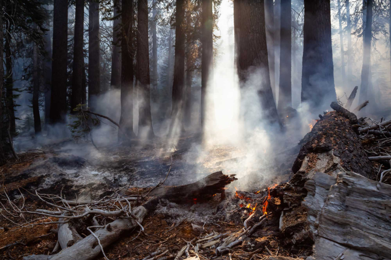
While California has made substantial progress in increasing acres treated, not all treatments contribute equally to reducing wildfire hazard. Precisely measuring treatment impact remains challenging, but evidence suggests that some treatments have longer-lasting impacts than others and that combined treatments, such as mechanical treatment followed by beneficial fire, provide the greatest benefit. The disposal of woody biomass generated as a byproduct of vegetation treatment also affects wildfire hazard. Biomass that is not removed or burned on site can be fuel for a future wildfire. Currently, most woody biomass is left on site after treatment.
How California Reduces Wildfire Hazard
Proactive vegetation treatment helps protect communities and reduce wildfire severity. Several treatment methods are used to reduce wildfire hazard (Figure 8).
- Mechanical treatment (64% of treatment). Involves the use of heavy machinery and hand crews with chainsaws to remove and thin vegetation, ranging from grasses and brush to small trees. Some practices aim to restore more resilient, historical conditions while others create fuel breaks. These approaches reduce fire risk by removing highly flammable vegetation such as grasses—often in areas with significant human activity, including along highways.
- Beneficial fire (18% of treatment). Uses prescribed fire (planned, controlled burning), cultural burning (Tribal-led fire stewardship practices), and managed fire (wildfire that is allowed to burn). These treatments are applied under weather conditions that allow the burn to be safely controlled. Beneficial fire is often paired with mechanical treatment because it can efficiently remove fine fuels after mechanical thinning.
- Targeted grazing (12% of treatment). Uses livestock—either cattle or goats—to remove low-to-the-ground fuels. This method is often applied where beneficial fire is not feasible and grass and other small fuels are the primary hazard. It is commonly used to manage regrowth in areas previously affected by wildfire.
- Timber harvest (6% of treatment). Involves work done with the primary objective of harvesting timber to produce wood products. This may mean removing small trees while retaining larger, more fire-resilient trees. These practices differ from clearcuts, which remove all trees. Although timber harvest is not primarily intended to reduce wildfire hazard, it can reduce fuel loads and lower wildfire hazard.
Mechanical treatment is the most common treatment method
Percent of treatment
SOURCE: California Wildfire and Forest Resilience Task Force Interagency Treatment Dashboard.
NOTES: Mechanical treatment includes, in the order of the most to the least common: herbicide application; thinning (mechanical and manual); piling; size-reducing activities including chipping, mastication, lop and scatter; and mowing.
Treatment Longevity
Treatment impact and longevity vary widely by treatment type, intensity, and location—impacts can last from less than a year to multiple decades. The dashboard currently does not reflect this and could benefit from classifying data based on the expected treatment longevity.
- Short-lived treatments (typically one year, sometimes lasting two years or more) target grasses and other fast-growing, low-lying vegetation. These include livestock grazing, mowing, and herbicide application, which together made up about 42 percent of statewide treatment effort.
- Longer-lived treatments (over two years) include beneficial fire, mechanical treatment, and timber harvest. About 39 percent of statewide treatments target small-diameter trees and other large, woody vegetation through mechanical treatments or timber harvest, with benefits that can last up to 20 years (Brodie et al. 2024). Beneficial fire accounts for the remaining treatments reported and typically provides benefits up to ten years, but repeating burns at regular intervals can extend benefits further (Keifer et al. 2006).
No single approach is sufficient. Meaningful hazard reduction requires treatments that match local conditions and the type of treatment may vary over time. Thinning may be effective in dense forests with excess small-diameter trees. By contrast, fuel breaks may be needed in areas where shrubs are in close proximity to homes.
Combined Treatment
Many locations require multiple types of treatment to meaningfully reduce wildfire hazard. Yet on average, about 54 percent of sites received a single treatment, while 36 percent received two to four and about 10 percent received more than four treatments.
The most effective mix of activities depends on local conditions. One broadly applicable, high-impact approach is mechanical treatment followed—typically after some time—by beneficial fire, referred to here as combined treatment (Safford et al. 2021). About 47,000 acres per year (just 8% of acres treated) have received combined treatment (Figure 9).
These analyses suggest that, in the long run, more intensive, sustained treatment may be needed to comprehensively reduce wildfire hazard.
A relatively small but growing acreage receives high-impact combined treatment
Thousands of acres treated
SOURCE: California Wildfire and Forest Resilience Task Force Interagency Treatment Dashboard.
NOTES: Combined treatment data include acres treated with at least one mechanical treatment activity and at least one beneficial fire activity. The totals reported here reflect footprint acre sums across all treatments that meet this criteria. See Technical Appendix B for details on calculation methods and data limitations.
The million-acre target measures progress by acres treated, regardless of treatment longevity, location, or sequencing. Counting all acres equally may incentivize spreading effort over a broad area rather than concentrating durable, high-quality treatments where they are needed most. Task force targets should strike a balance between incentivizing widespread protection and providing long-term hazard reduction in critical areas.
Managing Woody Biomass Left After Treatment
After mechanical treatment is completed, the way vegetation is handled affects wildfire hazard as well as broader environmental and public health outcomes. Herbicide application, while grouped with mechanical treatments in the dashboard, is a chemical treatment and typically does not leave behind biomass. In contrast, other mechanical treatments often leave behind substantial biomass. We focus on those treatments below.
- Leaving woody biomass on site. About 38 percent of these treatments leave this material on the landscape. Material reported as moved to a different location may still be a source of fuel for wildfires depending on the methods used.
- Processing woody biomass on site. About 10 percent of these treatments process woody biomass on site to make it smaller, accelerating its breakdown and reducing wildfire hazard.
- Unknown woody biomass outcomes. About 52 percent of these treatments have no information on where the woody biomass ends up. Universal reporting of this information would help identify opportunities to increase biomass use and reduce wildfire hazard.
Burning woody biomass in piles
Pile burns are a form of beneficial fire in which woody biomass is collected and burned under controlled conditions. Pile burning accounts for about 5 percent of all treatments and, when managed well, effectively eliminates concentrated fuel. However, it releases greenhouse gases, can pose smoke-related health risks, and may be difficult to conduct under air quality regulations.
California’s mechanical treatments vary in how effectively they reduce wildfire hazard. Woody biomass left on the landscape may provide fuel for future wildfires. Processing biomass on-site reduces wildfire hazard, while pile burning eliminates concentrated fuel but creates tradeoffs with air quality and emissions. Increasing off-site biomass use where feasible would better reduce wildfire hazard and limit air quality and emissions impacts.
Where Treatment Is Occurring across the State
The effectiveness of California’s wildfire resilience efforts depends not only on the number of acres treated and the quality of those treatments, but also on whether work is concentrated in areas of greatest need from a statewide perspective. The projects reported in the dashboard were designed and implemented to meet local objectives—they were not necessarily intended to align with task force priorities. In this section, we apply our definition of priority areas to examine how treatments are distributed across headwater regions and land ownership types. This analysis does not evaluate treatment effectiveness, but it reveals how the portfolio of projects reported in the dashboard aligns with task force goals and where additional focus may be needed.
Across Priority Areas
Most treatment occurs in locations where it is likely needed. The majority (83%) of acres treated were located either in a priority area or within one kilometer of a priority area (Figure 10). About three-quarters of these acres are in or near areas that Cal Fire has determined need treatment, and about one-third are located near communities in the wildland-urban interface. Most of the treatments outside priority areas reflect work by Caltrans on reducing roadside ignitions and by the California Department of Fish and Wildlife work on habitat management.
The areas treated align very closely with priority areas, suggesting that much of the work occurring in the state could be meaningfully advancing wildfire hazard reduction goals. However, the priority areas used in this analysis provide only a coarse statewide picture of areas where treatment may be most needed. Regional and local priority mapping would add to the statewide picture, helping to identify whether treatment efforts are reaching the highest-need areas.
Most treatment occurred in or near priority areas
SOURCE: California Wildfire and Forest Resilience Task Force Interagency Treatment Dashboard.
NOTE: The acres treated shown here include tree planting efforts due to data limitations.
Across Regions
The Southern California, Central California, and North Coast headwater regions receive less treatment relative to the amount of priority area they include (Figure 11). Addressing these gaps is important, as these regions face significant wildfire risks to communities and water supplies. The North Coast and Central California regions had 11 and 18 percent of acres treated, respectively, despite accounting for 16 and 25 percent of priority areas. The gap is largest in Southern California, with only 3 percent of acres treated despite representing 7 percent of priority areas. In contrast, the Sierra–Cascades account for 26 percent of priority areas but had about 29 percent of acres treated—and likely more, as timber companies are disproportionately concentrated there and may account for many treatments with no reported location.
Scaling up treatment efforts in headwater regions beyond the Sierra–Cascade region will be challenging due to differences in ecosystem types and treatment methods. Fragmented land-ownership in these regions also presents challenges for coordination and comprehensive data reporting, and treatments by private landowners may currently be underreported.
- Sierra–Cascade Mountains. Most of this region is conifer forests owned by the US Forest Service. Treatment methods mirror statewide averages except that almost no targeted grazing occurs—unsurprising given that the region has little grassland.
- North Coast Mountains. This region is similar to the Sierra–Cascades, with large proportions of conifer forest owned by the US Forest Service, but there is greater use of beneficial fire than in the Sierra–Cascades.
- Central California Foothills and Coastal Mountains. About three-quarters of the land is owned by private individuals. Numerous land-ownership boundaries make it difficult to scale treatment. This region also has extensive grasslands, many of which are managed with targeted grazing.
- Southern California Mountains. Most treatment in this region uses mechanical methods. Beneficial fire is rarely used, largely due to the high proportion of the wildland-urban interface. The region is also dominated by shrublands, which require different treatment methods than forests, such as fuel breaks.
Southern California, Central California, and North Coast headwater regions are undertreated
SOURCE: California Wildfire and Forest Resilience Task Force Interagency Treatment Dashboard.
NOTES: “Percent of acres treated” indicates the share of total acres treated in each region. “Percent of priority areas” indicates the share of priority areas that fall in each region. The “no location provided” category includes acres treated with no spatial information. Most data without locations were reported by timber companies, which suggests that acres treated in the Sierra–Cascade and North Coast Mountains headwater regions may be underestimated. See Figure 1 for details on the four headwater regions.
By Landowner Type
Scaling up treatment on lands owned by private individuals is an important component of reducing statewide wildfire hazard. Based on reported data, these lands receive relatively little treatment—they account for only 9 percent of acres treated, even though about half of all priority areas are owned by private individuals (Figure 12). Treatment on private lands is likely underreported, as some landowners may lack the capacity to report their efforts, so the gap may be smaller than the data suggest. In contrast, state agencies own only about 3 percent of priority areas but reported 22 percent of acres treated. Fragmentation of land across many private individuals makes coordination difficult, and many of these landowners may lack the knowledge or capacity to carry out effective treatments.
Lands owned by private individuals may be undertreated
SOURCE: California Wildfire and Forest Resilience Task Force Interagency Treatment Dashboard.
NOTES: “Percent of acres treated” indicates the share of all acres treated that occurred in each land ownership. “Percent of priority areas” indicates the share of all priority area in each landowner category. Other ownership includes NGOs, tribes, and local governments.
These treatment patterns suggest that California’s efforts are well-targeted but unevenly distributed. Most treatment occurs in or near priority areas, which is encouraging. However, Southern California, Central California, and the North Coast receive less treatment than their share of priority areas may warrant, and lands owned by private individuals are substantially undertreated relative to their share of priority acreage.
Interpreting these gaps requires caution, as reporting limitations affect tracking across regions, landowner types, and treatment categories. Better data and strategies that account for differences in ecosystem types, land-ownership, and reporting capacity will be needed to determine where efforts are falling short and how best to address them.
Policy Recommendations
California has made meaningful progress in treating more acreage to reduce wildfire hazard, as well as developing expanded partnerships, data sharing, and coordination. However, as of 2024, the state has not yet met the annual million-acre goal. Opportunities likely remain to better target areas of greatest need and to distribute and sequence treatments over the landscape. In particular, private lands may have a gap in treatment coverage, though underreporting makes it difficult to assess the full amount of work done on these lands. Headwater regions face some of the highest wildfire hazard in the state, but treatment levels and their effectiveness are difficult to assess with current data. And the current tracking system emphasizes counting acres treated rather than the impact and longevity of treatments.
Our recommendations focus on improving tracking and reporting so that treatments target areas where they are most needed. Improved tracking would also incentivize durable treatment types that build long-term resilience and provide better data to inform future policy decisions. Since tracking and reporting span multiple agencies, landowners, and funding programs, responsibility for implementing these recommendations should be shared. The task force is best positioned to play a coordinating role through its member agencies and partners. It could help establish common definitions and reporting expectations, synthesize data across sources, and elevate findings to policymakers.
Better data would help policymakers make more informed decisions about related policies as well as associated funding needs. Vegetation treatment in headwater regions has implications for water supply reliability and quality, and better tracking data would help water agencies and other beneficiaries assess whether landscape treatments are providing the expected benefits.
- Clarify and standardize how priority areas are defined. Are treatments occurring in areas where they are needed most? We define priority areas based on a combination of wildfire hazard and community exposure. If the task force adopted a similar approach, it would be easier to interpret if reported treatments align with task force objectives. Defining priority areas should involve the task force setting clear objectives; the monitoring, reporting, and assessment work group identifying the appropriate data and metrics; and the science advisory panel reviewing the selections. The task force would then assess how regional plans align with their statewide priorities.
Who’s responsible: The task force, including the monitoring, reporting, and assessment work group and science advisory panel.
- Identify persistent gaps in treatment coverage. Our analysis shows that the extent of treatment varies substantially across landowners and regions, with relatively limited data reported on lands owned by private individuals and in headwater regions outside the Sierra–Cascades. Further analysis is needed to determine whether this reflects a gap in treatment or underreporting. In forested areas where treatment is appropriate, tracking data should be used to flag persistent gaps in coverage to help decision makers understand where additional attention may be warranted. The task force’s monitoring, reporting, and assessment work group should identify ways for private landowners to better report treatment data and determine how to address these gaps.
Who’s responsible: The monitoring, reporting, and assessment work group of the task force.
- Refine tracking and reporting by treatment longevity. The current emphasis on acreage targets provides a measure of the scale of effort, but it does not directly indicate progress toward wildfire resilience. Treatments differ in how long they reduce wildfire hazard, but these differences are not currently accounted for in task force tracking and reporting. Where data allow, the dashboard should distinguish between short-lived treatments, such as mowing, grazing, and herbicide application, and longer-lived treatments, including mechanical thinning and prescribed fire. Tracking and assessing treatments by longevity would improve transparency in measuring progress toward wildfire resilience. The dashboard should also make it easier to track combined treatments, including mechanical thinning followed by prescribed fire, which tends to provide the longest-lived wildfire hazard reduction benefits. Incorporating metrics that better account for treatment longevity, placement in priority areas, combined treatments, and what happens to woody biomass would more closely align task force goals with the objective of sustained resilience to high-severity wildfire.
Who’s responsible: The monitoring, reporting, and assessment work group, working with Cal Fire and dashboard contractors.
- Require consistent reporting of treatment location. Inconsistent reporting of treatment locations makes it difficult to assess treatment overlap, intensity, and cumulative impact. All treatment reporting should be required to include a standardized spatial footprint. This would substantially improve the ability to accurately track progress towards wildfire hazard reduction goals. Existing efforts within the task force to improve spatial reporting should be continued and expanded. Funding agencies such as the US Forest Service, Cal Fire, and the state conservancies should require such reporting to receive grant funds. Additionally, the US Forest Service and Cal Fire should use their timber harvest permitting processes to require spatial reporting from timber companies.
Who’s responsible: The US Forest Service, Cal Fire, and the state conservancies.
- Build reporting capacity for small and under-resourced partners. Our analysis and discussions with non-governmental organizations and regional conservancies indicate that many small, local organizations, private landowners, and Tribes lack the technical or administrative capacity to report treatment data in the dashboard. As a result, some treatment efforts are underrepresented in statewide tracking. Providing targeted training, technical assistance, or simplified reporting pathways would help improve data completeness and consistency. The Regional Forest and Fire Capacity Program is already funding capacity-building and should expand to include reporting capacity. The task force could play a coordinating role in identifying these needs and supporting partners in meeting reporting expectations. State and federal funding agencies should provide resources to support reporting through grant programs and other funding streams. Progress on reporting will also require funding for adequate staff capacity within the task force and its member agencies.
Who’s responsible: The Regional Forest and Fire Capacity Program, the task force, and state and federal funding agencies.
A fundamental challenge lies in identifying sustainable funding for treatment at the pace and scale required to address wildfire risk. While significant progress has been made in a few watersheds, much of the broader public funding in recent years has come from bond measures rather than ongoing programmatic funding, and additional resources are likely needed.
Conclusion
As wildfire risk continues to grow, California is working to expand treatment of lands most likely to burn at high severity. Better data on the work being done would help agencies and partners improve the quality, durability, and placement of treatments in the areas that need them most. The recommendations in this report point to ways to strengthen that data, and recent improvements in coordination and information sharing show that progress is achievable. With both refined tracking systems and sustainable funding in place, California would be better positioned to reduce wildfire impacts on communities, the environment, and water supplies.
Topics
Forests and Fires Paying for Water Safe Drinking Water Water Supply Water, Land & Air